Hello, knowlrain; welcome to the forum.
Quote:
Originally Posted by knowlrain

That's fine, in that I can see the coverage map for each transmitter. However the section also describes being able to hover over different transmitters in that coverage map to see details like transmitter power, compass direction, etc., in a pop-up balloon.
It's depicted in this image: http://www.tvfool.com/images/stories/station_detail.jpg |
That image is for Google Earth transmitter icons, not Interactive browser.
Quote:
|
Is this map with several transmitters only available in Google Earth, or am I missing some button somewhere? Thanks
|
Only Google Earth if you can get it to work; I haven't mastered it yet.
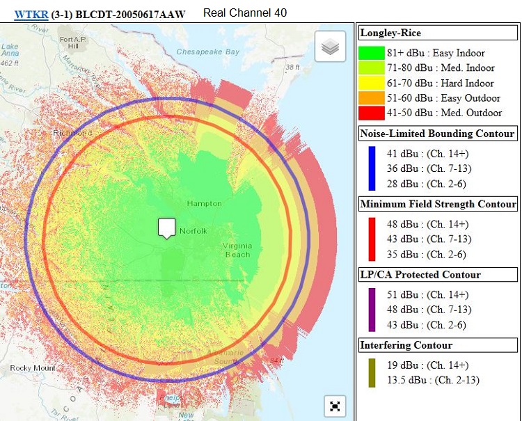
You can get coverage maps, one at a time as you have found out, with the Interactive browser. You can also get FCC coverage maps for any given callsign. For example, WTKR:
https://www.rabbitears.info/
Enter WTKR in Find: Call Sign box and click on search, which will take you here:
https://www.rabbitears.info/market.p...&callsign=WTKR
Scroll down to WTKR and click on Technical Data
Click on RabbitEars TV Query which should take you here:
https://www.rabbitears.info/tvq.php?...ms&facid=47401
Scroll down to WTKR Channel 40
Click on Longley-Rice Coverage Map, which should take you here:
https://www.rabbitears.info/contour....a&site=1&map=Y


