Quote:
|
I can't really generate a new report because I need to physically hike up the hill to figure out the coordinates and plan which tree to use as a mast.
|
I estimated your location and used the tvfool interactive map feature for this report:
http://www.tvfool.com/?option=com_wr...d243c78918b8a1
Pretty close to your original report.
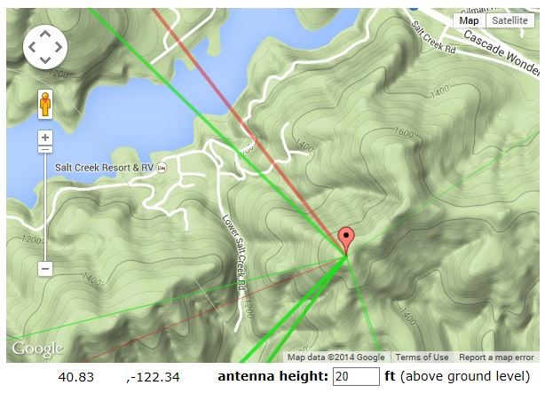
I then moved the teardrop cursor to the top of the hill south of you (20 ft up in the tree) and got this report:
http://www.tvfool.com/?option=com_wr...d2438e744b90c9
The signals look much better.
For your protection, I erased some of the coordinate numbers just the way tvfool does in a report that uses coordinates.
10 ft up:
http://www.tvfool.com/?option=com_wr...d243424a5cb5be
5 ft up (if nothing is in the way in front of it):
http://www.tvfool.com/?option=com_wr...d2432a53ca1d25
If you decide to use a preamp up the hill, use RG6 that has a solid copper center conductor rather than copper coated steel. The voltage loss for the preamp is much less with the solid copper conductor. The TV signals just use the copper coating, but the DC for the preamp uses the full cross section of the conductor. RG11 would have less loss, but it is a lot of trouble to work with.