Quote:
Originally Posted by Badfish740

I sent rabbit73 my address for further analysis, so we'll see what he comes back with,
|
Thank you for the exact address. The summer Google aerial view shows a lot of trees around your house, but the ground photo looks more open.
Quote:
|
I did some investigation of my own via Google "My Maps" which allows one to plot coordinates on a map (ie: My house, various transmission towers) and draw lines between them.....the line between my house and the Roxboro towers runs right through one 800+ foot peak, so not sure how that would impact signal.
|
I see the peak. Reception looks difficult, but not impossible.
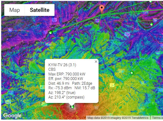
This is an image of your report:

This report from rabbitears.info should have a more accurate list of channels:


You can see you are on the fringe: